aplikace DroneMap
DroneMap – Rules and Restrictions for UAS in the Czech Republic
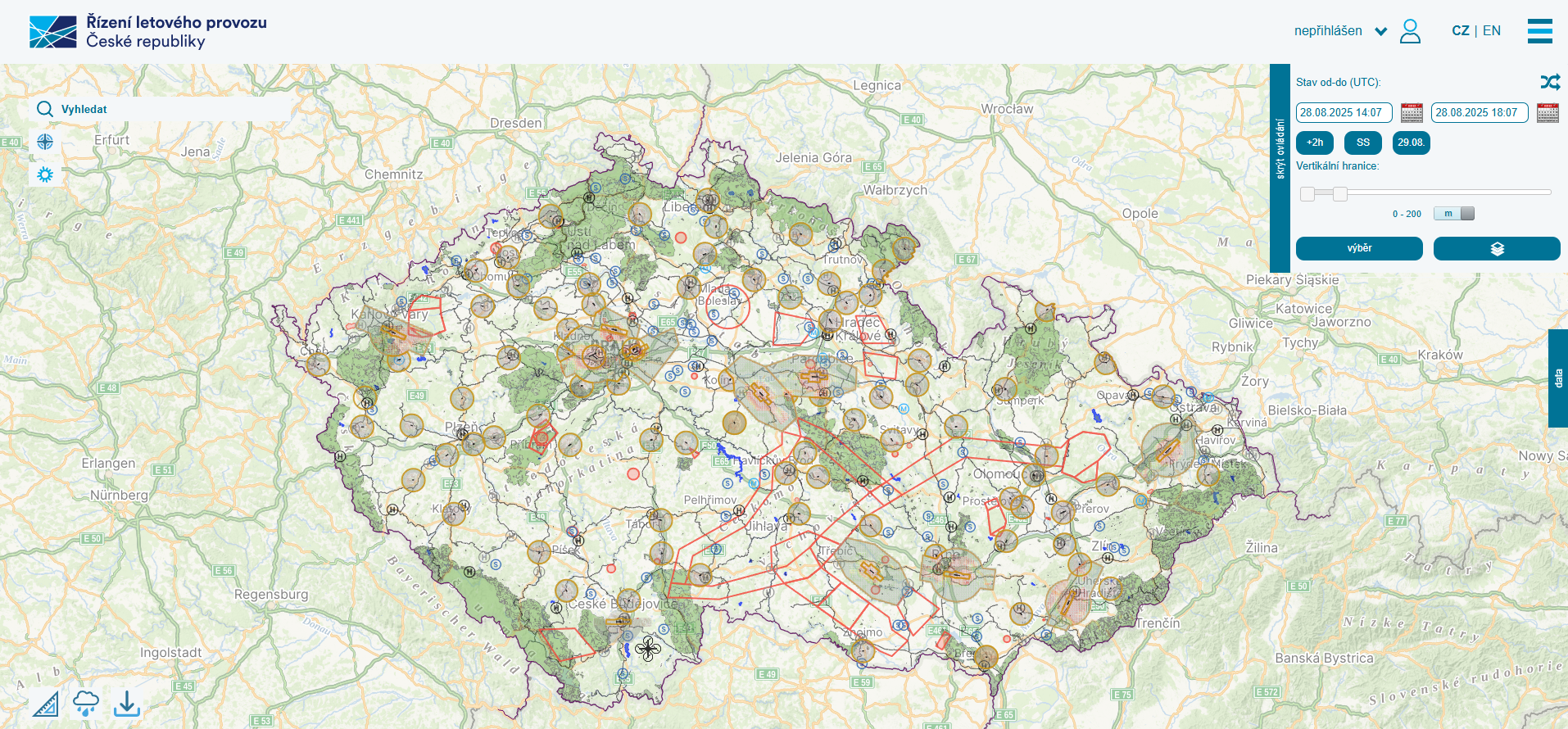
DroneMap displays the rules and restrictions for UAS in the Czech Republic. The DroneMap application is a centralised system used to manage, display and share information about the Czech Republic’s airspace, focusing on the rules and restrictions governing the operation of unmanned aircraft – that is, all so-called drones, as well as model aircraft and flying toys. The Civil Aviation Authority has entrusted the operation of this system to Air Traffic Control of the Czech Republic (ŘLP ČR s.p.).
The Mapy.cz API is used within the DroneMap system to display map data for the Czech Republic. It is used to visualise airspace, rules and restrictions for UAS operations directly within the map interface. This API was chosen due to its up-to-date and detailed map data, wide availability and reliability, which enable users to plan drone flights accurately and clearly.