PPGlog.com - letový deník
Flight log for powered paragliding
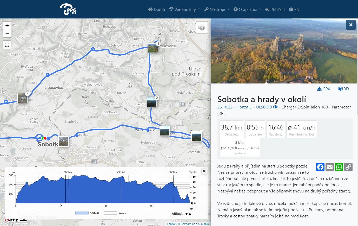
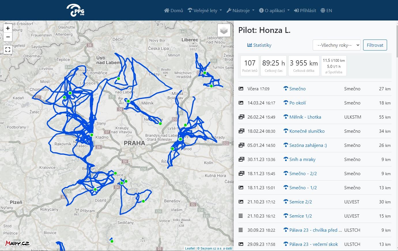
The app serves as a flight log for powered paragliding. Pilots can record their routes, add photos, track distance flown, fuel consumption and other statistics.
PPG Log offers:
- A record of the user’s flights
- Import from GPX and IGC files
- Altitude and speed profile display
- 3D flight view
- Photo gallery and photo display over the map
- Bulk display of all the user’s flights over the map
- Overall statistics (total distance, time, etc.)
We use the Maps API to display flights over a base map, a tourist map or an aviation map. We are also experimenting with tiles in the 3D view (Cesium) and use panoramas to preview take-off points. We use a geocoding API to generate launch site names.